
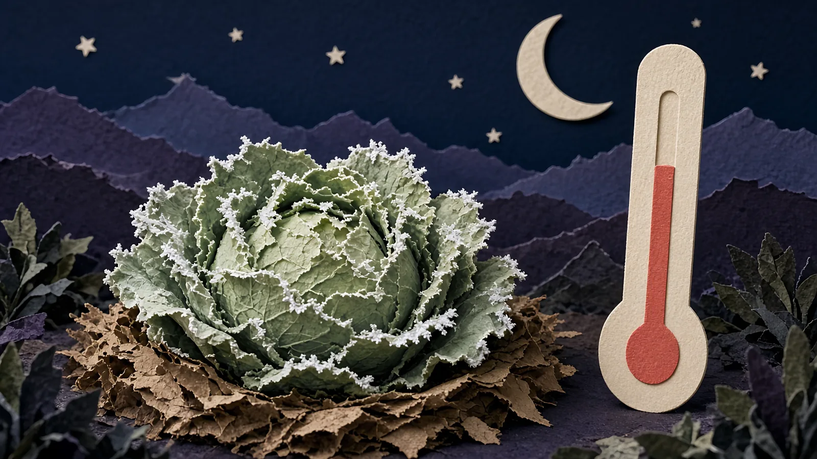
Frost is likely tonight if three things line up: a clear sky, calm or light wind, and dry air — a dew point down near or below freezing. Add a forecast low anywhere in the mid-30s or colder and tender plants are at risk, because the ground runs colder than the number on your phone.
The three signs of a frost night
Frost is ice that forms right on a surface — a leaf, the grass, your car roof — when that surface cools to freezing. Here's the part most people miss: the ground doesn't need cold air blowing in from somewhere else to get there. On the right kind of night it cools itself, by giving off its own heat straight up to the open sky.
So 'will it frost tonight?' isn't really a question about the number on your phone. It's about whether the ground can lose its heat fast enough to freeze. Three things decide that, and you can read all three standing in the yard at dusk.
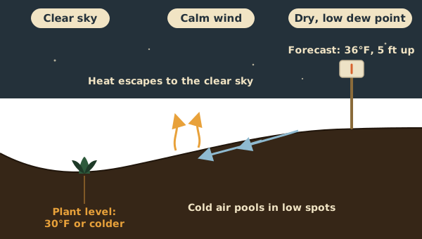
A clear sky. Clouds work like a blanket — they catch the ground's heat and hold it near the surface. Take the clouds away and that heat pours straight up and off into space, and the ground cools fast (National Weather Service). Clear night, cold ground. That's sign one.
Calm or light wind. Wind stirs the warmer air from higher up down into the cold layer sitting on the ground, and keeps that cold layer from ever really settling in. A still night lets the cold pile up. Right where your plants are. Once the wind picks up past about 6 mph, frost gets a lot less likely (National Weather Service).
Dry air — a low dew point. This is the one nobody teaches, and it's the tell that separates a scary-looking night from a truly dangerous one. Dry air cools faster and further than damp air, so a dry night can slide toward freezing while a muggy one won't. It gets its own section next.
One quick gut-check before you panic. If the grass is already soaked with dew at dusk, or fog is settling in, you can usually relax — that only happens when the air is damp, and damp air won't fall far. The night to watch is the opposite: clear, still, and dry, with the stars out sharp and the grass bone dry (Michigan State University Extension).
The dew-point rule: the tell most people never learned
Every weather app shows a number called the dew point, and almost nobody uses it. The dew point is just the temperature where the air gets so full of moisture it starts leaving water behind — dew on the grass, fog in the air. High dew point, damp air. Low dew point, dry air. That's the whole idea.
Here's why it's the best frost tell you've got: on a clear, calm night, the temperature falls toward the evening dew point and then mostly stalls out there. As the air cools to that point, moisture starts condensing out, and that gives off a little heat — enough to put the brakes on the fall (Michigan State University Extension). So the evening dew point is a rough floor for how cold it'll get tonight.
That gives you a fast read at sunset. If the dew point is above about 45°F, you're probably fine. If it's below 40°F on a clear, calm night, expect frost (University of Wisconsin–Madison). And once the dew point drops below freezing, frost gets even more likely, because dry air cools faster than damp air (South Dakota State University Extension). Low dew point, clear sky, no wind. That is the combination.
It's a rule of thumb, not a promise — the dew point itself can drift down a few degrees overnight, so treat it as a floor you could still slip under, not a guarantee (Michigan State University Extension). To find it, open any weather app and look for 'dew point' in tonight's hourly details, right next to the temperature. Read this evening's number, not the afternoon's.
Why the forecast can be wrong for your yard
The low on your phone is measured about five feet off the ground, out in the open — and your garden is neither of those things. That gap is why the forecast can say 36°F and your beds still get hit.
On the exact clear, calm nights frost shows up, the air right down at plant level runs colder than the air five feet up — the National Weather Service puts the difference at up to 10°F (National Weather Service). So frost can form on the grass while the official reading never drops below the mid-30s (Michigan State University Extension). Treat a forecast low anywhere near freezing as a real risk. Not a maybe.
Your yard has its own cold spots, too. Cold air is heavy, so on a still night it slides downhill and pools in the low, open places — a dip in the lawn, a bed at the bottom of a slope (National Weather Service). A spot tucked against the house usually runs a few degrees warmer. Same yard, different outcomes on the same night.
Here's the honest limit: nobody can tell you the exact temperature one bed will hit tonight. No app, no forecast, us included. What you can do is learn your own yard. Stick a cheap min/max thermometer out in your coldest bed, and morning after morning it'll show you how far under the forecast that spot really runs (Michigan State University Extension).
You can stack the odds ahead of time, too. Look up how likely frost is for your spot and date, and see exactly how those odds are built in our frost-date method. Knowing your frost odds, and which corners of your yard run cold, tells you which nights are worth walking out to check at dusk.
How to tell if frost is coming tonight
Put it together and it's a 60-second check at dusk. Three numbers. Run down these five in order and you'll know whether to head out with the covers or leave the garden be.
- Check tonight's low. Pull up the overnight low. Frost risk starts well before 32°F — anywhere in the mid-to-upper 30s is fair game, because your ground runs colder than the reading. A low in the low 30s or below means pay attention.
- Check the dew point. Find this evening's dew point in your app's hourly details. Above about 45°F, you're probably safe. Below 40°F on a clear, calm night, plan on frost. Below freezing, it's likely — dry air is what lets the temperature fall furthest.
- Check the wind and the sky. Step outside. Clear and still is the frost setup — stars out, no breeze. Clouds, or a wind over about 6 mph, tip the odds the other way, because both keep the ground from losing its heat. Heavy dew or fog already down? Usually a good sign.
- Check your spot against the forecast. Is your garden in a low, open dip where cold air pools, or tucked against the house? A cold-pocket bed can run several degrees under the forecast. If you've kept a min/max thermometer out there, you already know your number.
- Decide. Clear, calm, dry, a low near or below freezing, and a cold-pocket bed? That's a frost night — cover the tender stuff. Cloudy, breezy, or a dew point in the mid-40s or higher? You can usually leave it. When it's a genuine toss-up — and a dew point in the low 40s on a clear, calm night is a toss-up — cover anyway; a sheet costs you five minutes.
This tells you whether frost is coming. It doesn't tell you which plants care — a lot of your garden shrugs off a light frost, and some crops taste better after one. Once it's looking like a frost night, here's how to protect the plants that actually need it, tender ones first.
When frost forms — and the freeze you can't see
If it's going to frost, the coldest moment isn't midnight — it's right around sunrise. The ground gives up most of its heat fast, in the hours around sunset, then keeps cooling more slowly all night until the sun comes up and finally turns it around (FAO). That's why a bed can look fine at bedtime and be nipped by breakfast, and why frost covers go on in the evening, before the cold sets in, not at 2 a.m.
The white stuff itself forms two ways, and neither one falls from the sky. One way is water vapor freezing straight onto a cold surface as ice crystals, skipping the liquid step entirely (National Weather Service). The other kind is plain dew that forms first and then freezes as the surface keeps cooling. Either way, it needs a surface that's already at or below freezing.
Now the one that fools people. No frost on the grass does not mean your plants came through fine. On a really dry night the air may not carry enough moisture to make any crystals at all — so the temperature can drop below freezing with nothing showing, and still kill a tomato or a basil plant outright (University of Georgia Extension; Nebraska Extension). A clear, still, bone-dry night is the most dangerous kind, precisely because it doesn't look like much.
What the weather service terms actually mean
The words on the forecast are a rough map of how much trouble you're in. Start with the two that get mixed up. A frost is ice crystals on surfaces, and it can show up while the air is still in the mid-30s. A freeze is about the air itself — the temperature at plant height dropping to 32°F or below over a wide area (National Weather Service). You can get one without the other: frost with the air above freezing, or a dry freeze with no frost at all.
A frost advisory means the low is headed for about 33 to 36°F on a clear, calm night during the growing season — cold enough to nip tender plants (National Weather Service). Some offices word it around the moisture instead of the exact number, but the takeaway is the same: cover the tender stuff.
A freeze watch is a heads-up that a widespread freeze could hit in the next day or two. A freeze warning means it's coming — the low is going below 32°F for a good stretch, and unprotected tender plants will likely be lost (National Weather Service). Once it sits below about 28°F for very long, even many hardier plants go down (National Weather Service).
A hard freeze is the serious one. The National Weather Service defines it as the air reaching 28°F or lower for an extended stretch, cold enough to kill most plants outright (National Weather Service). One honest wrinkle: the exact cutoff shifts by region. Most offices use 28°F, but a warm-climate office like Tallahassee sets its hard-freeze bar down at 25°F (National Weather Service). When it's a hard freeze, a cover mostly stops mattering — that's harvest-what-you-can weather.
So it's a frost night. Now what?
Say you've run the check and it all lines up: clear, calm, dry, a low near freezing, and a garden that runs cold. The reading part's done. Now it's triage — figure out which plants actually care, then cover only those.
Most of your garden probably needs nothing. Only tender, warm-season plants die at a light frost; plenty of greens and root crops take it in stride, and several come out sweeter. Here's the whole playbook — what to cover, what to leave, and how to do it right — for the night it finally lands.
Frost and freeze FAQ
What is a hard freeze?
A hard freeze is when the air temperature reaches 28°F or lower for an extended stretch — cold enough to kill most plants, not just the tender ones. That's the National Weather Service's standard definition. The exact cutoff varies a little by region: most offices use 28°F, while some warm-climate offices, like Tallahassee, set it at 25°F. Once it's a hard freeze, covers mostly stop helping.
What's the difference between frost and freeze?
Frost is ice crystals forming on surfaces, and it can happen while the air is still in the mid-30s, because the ground cools faster than the air. A freeze is about the air itself — the temperature dropping to 32°F or below over a wide area. You can have one without the other: frost while the air stays above freezing, or, on a very dry night, a freeze that kills plants with no visible frost at all (National Weather Service; University of Georgia Extension).
What does a frost advisory mean?
A frost advisory means the National Weather Service expects a low of roughly 33 to 36°F on a clear, calm night during the growing season — cold enough to damage tender plants. It's your cue to cover warm-season crops like tomatoes, peppers, and basil, or bring pots in. A freeze warning is the more serious step up: the air itself is headed below 32°F (National Weather Service).
How cold does it have to be to frost?
Colder than you'd think at the surface, warmer than you'd think on the forecast. Frost can form when the official air temperature — measured about five feet up — reads in the mid-30s, because the ground and your plants run several degrees colder than that. As a rough guide, the NWS links a reported low of 33 to 37°F to areas of frost, and 32°F and below to widespread frost (National Weather Service). Treat a forecast low near freezing as a real frost risk.
What temperature does frost form at?
Frost forms when a surface — a leaf, the grass — cools to 32°F or below, which can happen while the air a few feet up is still around 33 to 36°F (South Dakota State University Extension). So there's no single air temperature that guarantees it. On a clear, calm, dry night, a forecast low anywhere in the mid-30s can leave frost on your plants by morning.
Can it frost when it's above 32°F, like 34°F?
Yes, and it's common. The temperature you see is measured about five feet off the ground, but the surface of your plants cools faster and can already be at freezing while the air reads 34 or 35°F (National Weather Service; Michigan State University Extension). That's exactly why frost advisories get issued in the 33 to 36°F range instead of at 32°F. A low of 34°F on a clear, still night is a cover night.
Sources
Every planting date, depth, and temperature on this page traces to these university extension guides. Where they differ, the ranges above hold the whole spread.
- National Weather Service (NOAA) — What Causes Frost? (La Crosse, WI)
- National Weather Service (NOAA) — Frost/Freeze Information (Charleston, WV)
- National Weather Service (NOAA) — Watch, Warning & Advisory Definitions (Baltimore/Washington)
- National Weather Service (NOAA) — Understanding Cold Weather Alerts
- National Weather Service (NOAA) — Frost and Freeze Information for the NWS Tallahassee Area
- National Weather Service (NOAA) — Glossary — Hard Freeze
- National Weather Service (NOAA) — Dew and Frost Development
- National Weather Service (NOAA) — Atmospheric Controllers of Local Nighttime Temperature
- Michigan State University Extension — Monitoring for the risk of frost and freezing temperatures
- University of Wisconsin–Madison SSEC (The Weather Guys) — How can you forecast frost?
- South Dakota State University Extension — Frost and Freeze Impacts on Plants
- University of Georgia Extension — Frost and freeze — what is the difference?
- Nebraska Extension in Lancaster County — Frost: Cold Temperatures Bring an End to the Gardening Season
- Food and Agriculture Organization of the UN (FAO) — Frost protection: fundamentals, practice and economics — Vol. 1
Will it frost tonight? Learn to read your own yard: the three signs of a frost night, the dew-point rule that predicts how cold it’ll get, why your garden runs colder than the forecast, and what the weather-service terms mean. Every temperature here traces to the National Weather Service and US university extension pages listed above.
Reading a frost night gets easier every season you pay attention. But it's a lot to hold in your head at 6 p.m. in October, on top of remembering which of your plants even care.
That's the idea behind GardenTrack: a garden app that remembers every plant you've got and tells you what to do and when — including a heads-up when frost's in your local forecast. The free app is open now. Want to try it? Start free.